|
| *****SWAAG_ID***** | 823 |
| Date Entered | 27/07/2014 |
| Updated on | 03/09/2014 |
| Recorded by | Doug Waugh |
| Category | Stone structure |
| Record Type | Miscellaneous |
| SWAAG Site | Preston Moor |
| Site Access | Public Access Land |
| Record Date | 24/07/2014 |
| Location | Sheepfold with washing pool beside the track just beyond the gate from the Grinton to Redmire road. |
| Civil Parish | Preston Under Scar |
| Brit. National Grid | SE 07944 93828 |
| Altitude | 341mtrs |
| Record Name | Sheepfold with washing pool |
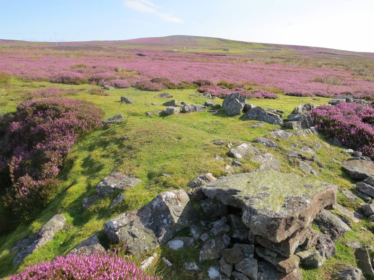
| Record Description | A large irregular sheepfold whose walls are now largely collapsed, but show significant differences in construction with large regular, worked stones in places as against rough, gathered, small stones elsewhere, suggesting many years use with occasional repairs. The walls have rounded corners and funnel towards the western side with a smaller gathering area built on to the main wall. The gathering area then narrows still further and leaves the fold with the main wall to the North and much less left of one to the South. This small area converges on a large flat stone above a pit which close inspection reveals to at least partially to have been lined with regular, worked stones. The wall to the North continues to become what appears to be the remains of a dam that blocked the small stream (Black Beck) that runs past so as to fill the pool. The dam remains can be seen to continue on the far bank of the beck. The overall purpose would seem to contain gathered sheep and then wash them in a constructed pool.
Although the walls follow the contours of the land and allow for such things as a coal pit, the site overall is flat, most of it varying less than a metre in height.
|
| Dimensions | 40mtrs x 27mtrs |
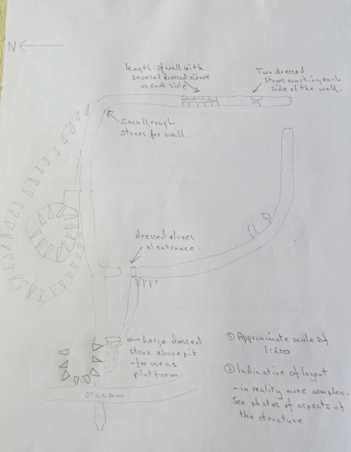
| Image 1 ID | 5817 Click image to enlarge |
| Image 1 Description | Drawing to indicate the shape and relationships within the whole site, but accuracy is not its strong point. | 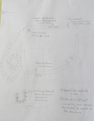 |
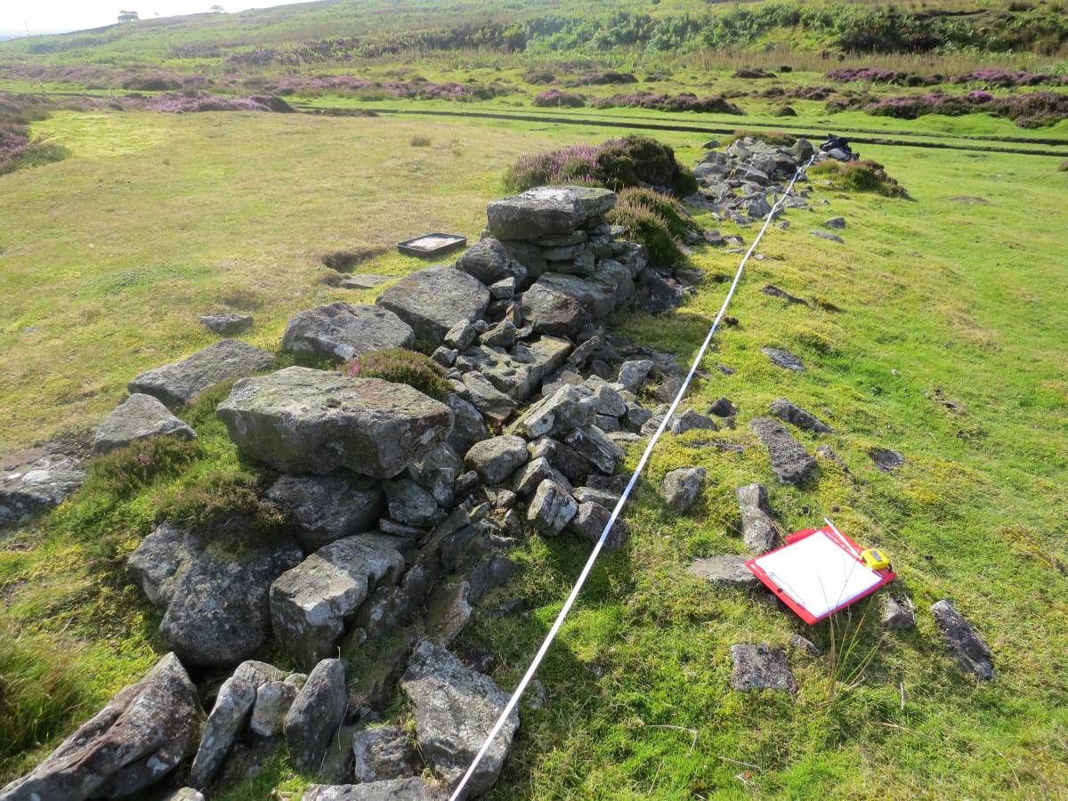
| Image 2 ID | 5804 Click image to enlarge |
| Image 2 Description | The East wall showing some high-quality stones and the clear wall-line. The East wall is both the straightest and contains the best stone. | 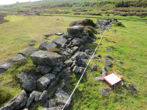 |
| Image 3 ID | 5627 Click image to enlarge |
| Image 3 Description | The North Wall from the washing pit back to the NE corner showing the meandering nature of this wall as well as the small internal enclosure where sheep will have been kept immediately prior to being immersed in the pit of water. | 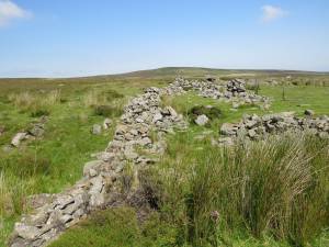 |
| Image 4 ID | 5805 Click image to enlarge |
| Image 4 Description | A small external enclosure (1.4m square), one side being the main wall, two having thin, flat stones on their sides (the only place this occurs) and the fourth side being the coal pit. Both this enclosure and the main wall go over the spoil from the pit which is part of a 19th century area of pits (Mines and Miners of Wensleydale by IK Spensley) suggesting the enclosure is no older than that. |  |
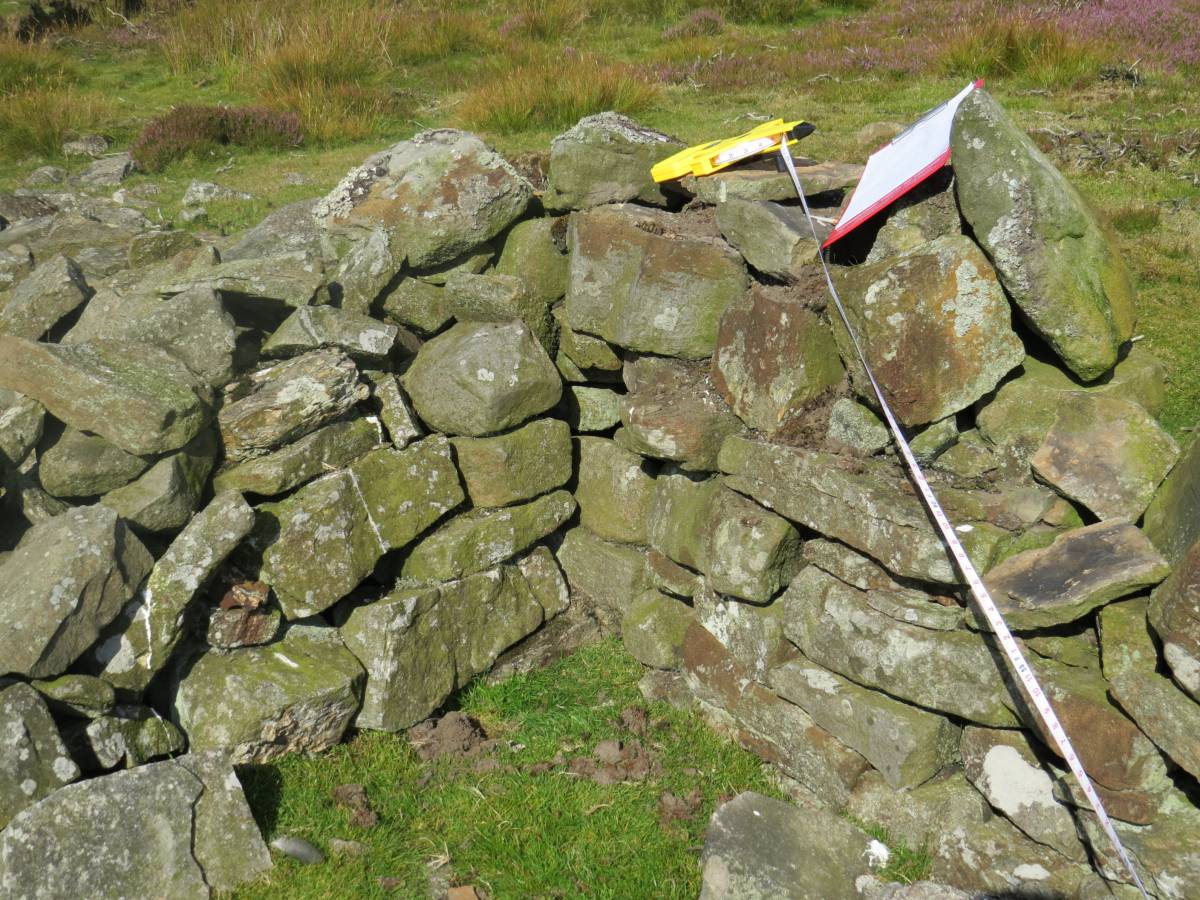
| Image 5 ID | 5806 Click image to enlarge |
| Image 5 Description | The junction of the main East wall and the internal enclosure showing one of the highest points of the overall enclosure. The internal enclosure is believed to have been used for gathering sheep immediately prior to their being immersed in the pool. |  |
| Image 6 ID | 5812 Click image to enlarge |
| Image 6 Description | The exit from the internal enclosure. Note the dressed stone on the left - which sits on another similar one. | 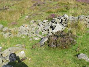 |
| Image 7 ID | 5808 Click image to enlarge |
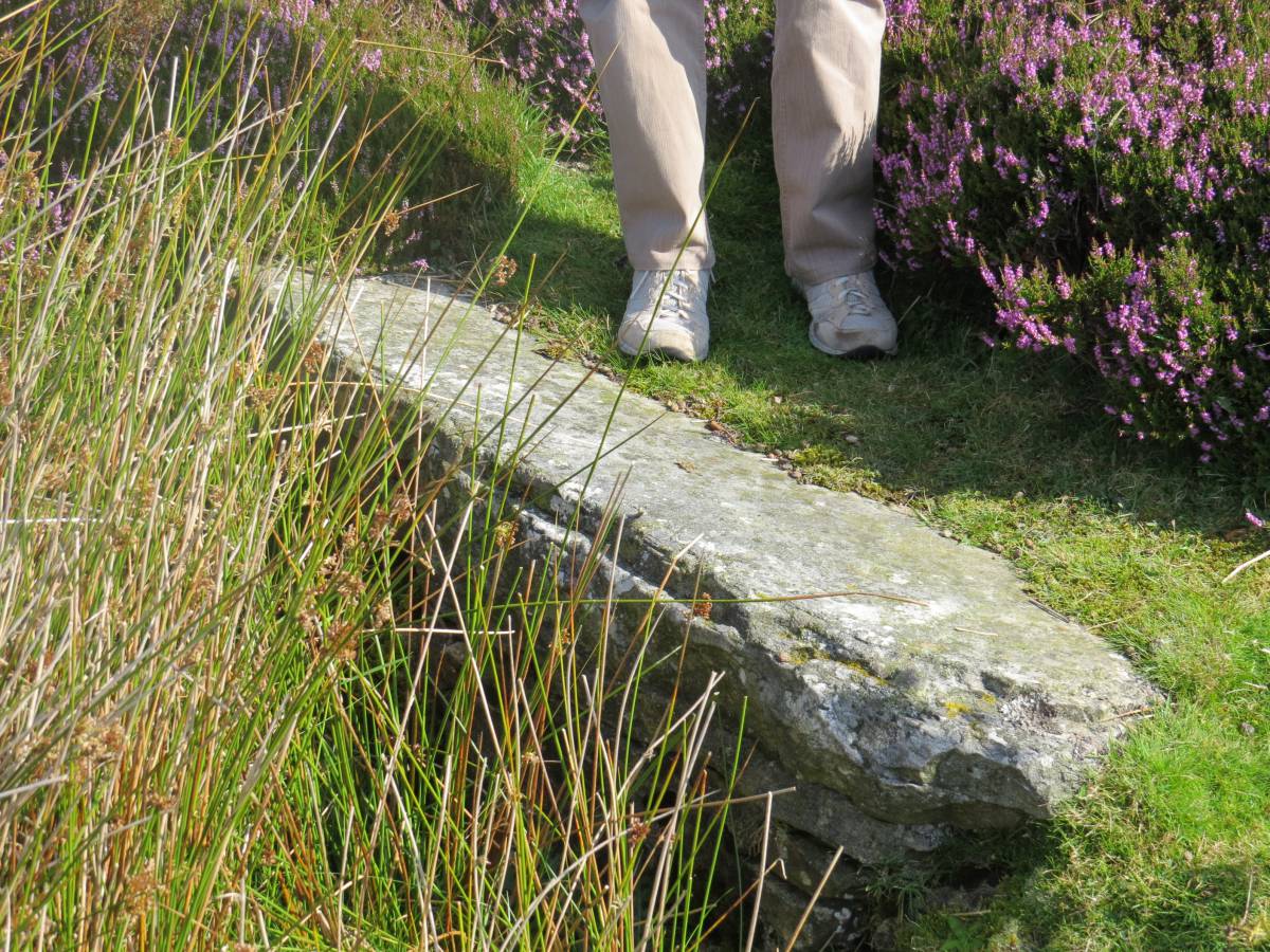
| Image 7 Description | From the internal enclosure it seems the sheep were brought to this large (at least 1.70m x 50cm) flat, dressed stone (SE 07909 93836)which was the platform for pushing the sheep into the pool. The stone sits on a well-built stack and has sides radiating on either side and forming the banks of the pool. The construction would support heavy weights and allow violent activity. | 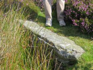 |
| Image 8 ID | 5630 Click image to enlarge |
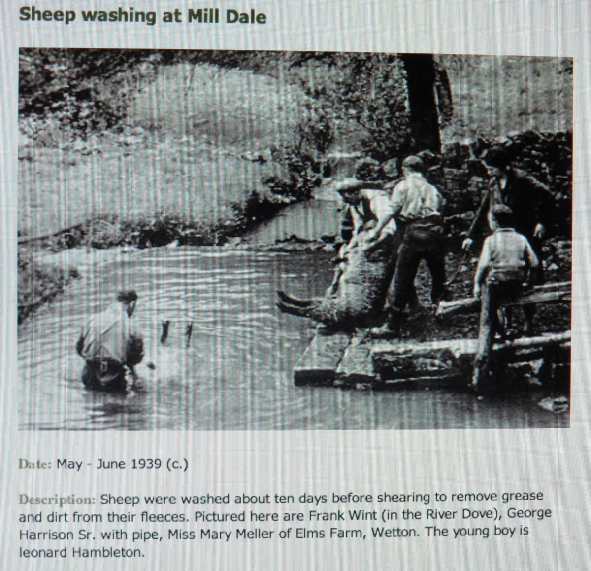
| Image 8 Description | Illustration and text from Staffordshire Past-Track, copyright Staffordshire County Council, showing a seemingly almost identical facility in use. Note the dam, permanent wall to the North, temporary wall to the South, the pool and the large, flat platform stone. |  |
| Image 9 ID | 5809 Click image to enlarge |
| Image 9 Description | Unusual, unidentified plant growing below the patform stone. | 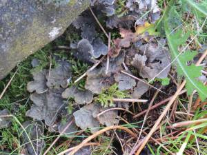 |
| Image 10 ID | 5807 Click image to enlarge |
| Image 10 Description | Loooking SE from the internal enclosure exit showing the way the wall curves round and there is another small internal circular enclosure at the apex. This wall is both the west and south side of the enclosure and finishes back at the entrance to the enclosure. | 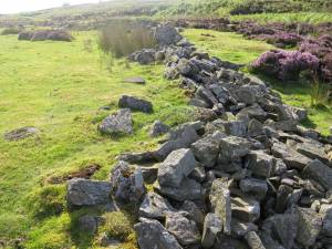 |